


 RSS news

 For some 600 million island-dwellers -- nearly one-tenth of the world’s population and representing one in three United Nations Member States -- biodiversity is integral to their subsistence, income, well-being and cultural identity.
Half the world’s marine resources lie in island waters. Biodiversity-based industries such as tourism and fisheries account for more than half the gross domestic product of small island developing states. Coral reefs alone provide an estimated $375 billion annual return in goods and services. Many island species on land and sea are found nowhere else on Earth. Legacies of a unique evolutionary heritage, they hold the promise of future discoveries -- from medicines and foods to biofuels.
Yet, reflecting a global pattern, island biodiversity is being lost at an unprecedented rate in the face of growing risks. Rising sea levels caused by climate change, ocean acidification, invasive alien species, overfishing, pollution and ill-considered development are taking a heavy toll. Many species face the prospect of extinction. People’s livelihoods and national economies are suffering.
The process to define a post-2015 development agenda and the Third Conference on Small Island Developing States in Samoa in September of this year both offer opportunities to attend to the unique needs of small island developing states and reverse the global decline in biodiversity. Because of their vulnerability, small island developing states are demonstrating a growing understanding of the links between healthy ecosystems and human well-being. Many have made local, national and regional commitments to conserve and sustainably use biodiversity, including through ratifying important instruments such as the Nagoya Protocol on Access to Genetic Resources and the Fair and Equitable Sharing of Benefits Arising from their Utilization. I call on all countries around the world to follow suit and ratify the Protocol without delay.
Around the world, many innovative partnerships are being forged to preserve marine and coastal resources, enhance resilience to climate change and develop sustainable tourism, fisheries and other industries. On this International Day, let us commit to adopting, adapting and scaling up best practices so we can protect fragile ecosystems for the benefit of all the islanders -- and indeed people everywhere -- who depend on them.
The GEOSS Architecture Implementation Pilot (AIP) develops and deploys new process and infrastructure components for the GEOSS Common Infrastructure (GCI) and the broader GEOSS architecture.
To present the GCI an "Introduction to the GEOSS Common Infrastructure (GCI)" virtual workshop will be held today 21 May 2013 at 14:00 UTC.
Agenda: In this 1 hour session we will take a "Tour of the GCI - everything you wanted to know about GCI" from a user perspective (outside view of the GCI; what is the goal of the GCI, what are ‘resources', Data-CORE and much more ...) (this includes a demo of the GeoPortal) and technical perspective (inside view the GCI; architecture and interfaces). We estimate a kif-kif split between user and technical perspective (don’t worry if you are not a propeller-head, the technical view will give you additional insight).
GEOSS speakers are (in alphabetical order): Doug Nebert (USGS), Guido Colangeli (ESA), Mattia Santoro (CNR), Steve Browdy (IEEE).
Intended audience:
- if you are new to GEOSS or AIP
- knew GEOSS or AIP from a while back and need a refresher
- in need for a general refresher
- general interest in GEOSS (but not a participant in AIP)
Virtual meeting details: https://www4.gotomeeting.com/join/628333311

GEO is a voluntary partnership of governments and organizations that envisions "a future wherein decisions and actions for the benefit of humankind are informed by coordinated, comprehensive and sustained Earth observations and information." GEO membership includes 89 nations and the European Commission, and 77 Participating Organizations comprised of international bodies with a mandate in Earth observations.
GEO Appathon 2014 is designed to create new, exciting and easy-to-use Apps using Earth observation data available through GEO’s Global Earth Observation System of Systems (GEOSS). GEOSS is a unique, web-based clearinghouse that provides access to more than 65 million data records from archives spread across the globe. (www.geoportal.org)
"GEO Appathon 2014 is one of the critical next steps in the evolution of GEOSS to create mechanisms to readily convert data into information and tools for decision makers across society," stated Barbara J. Ryan, Secretariat Director of GEO. "The Appathon is an important leap forward in unleashing the power of Earth observations."
Apps will focus on addressing environmental and societal challenges facing decision leaders and individual citizens in developing countries across nine essential areas: agriculture, biodiversity, climate, disasters, ecosystems, energy, health, water and weather.
"Access to better information, in the hands of people who can use it every day, is a major step forward. This appathon goes beyond the open data movement. The aim is to turn data into decisions," said Carrie Stokes, Director of USAID’s GeoCenter.
In addition to USAID, partners in the GEO Appathon include Esri, European Space Agency, Geospatial Media, GISCloud, Microsoft, National Research Council of Italy, and Open Geospatial Consortium.
Participation in the GEO Appathon is open to any non-commercial entity, individual or team from any background in any country. Apps can be created for any of the main operating systems, as well as open source platforms, and can be designed for any type of portable device. All Apps will be judged and the top winners will receive a cash prize and a year-long GEO network endorsement and publicity for the App. Registration for the GEO
Appathon remains open through July 31st. Qualifying Apps must be received by August 31, 2 014.


Philosophical Transactions of the Royal Society B (2014) doi: 10.1098/rstb.2013.0190
Assessing and predicting ecosystem responses to global environmental change and its impacts on human well-being are high priority targets for the scientific community. The potential for synergies between remote sensing science and ecology, especially satellite remote sensing and conservation biology, has been highlighted by many in the past. Yet, the two research communities have only recently begun to coordinate their agendas. Such synchronization is the key to improving the potential for satellite data effectively to support future environmental management decision-making processes. With this themed issue, we aim to illustrate how integrating remote sensing into ecological research promotes a better understanding of the mechanisms shaping current changes in biodiversity patterns and improves conservation efforts. Added benefits include fostering innovation, generating new research directions in both disciplines and the development of new satellite remote sensing products.

A new updated version of Euro+Med Plantbase was made available online in the middle of April 2014. For the first time, the economically important gymnosperms (coniferous trees), and the genus Thalictrum, as the first part of the large Ranunculaceae family, are treated in Euro+Med Plantbase.
Euro+Med Plantbase integrates and critically evaluates information from Flora Europaea, Med-Checklist, the Flora of Macaronesia, and from regional and national floras and checklists from the area as well as additional taxonomic and floristic literature. This is complemented by the European taxa of several families taken from the World Checklist of Selected Plant Families and of the Leguminosae from the International Legume Database and Information Service ILDIS. By April 2014 it provides access to 187 plant families, corresponding to ca. 92 % of the European flora of vascular plants.
The Euro+Med Plantbase web portal is accessible at http://ww2.bgbm.org/EuroPlusMed/.
Web services for Euro+Med merged with Fauna Europaea, ERMS, and Index Fungorum are provided by VLIZ at http://www.eu-nomen.eu/portal/webservices.php. The services will be also registered for use in EU BON in summer 2014.
The Heinz-Nixdorf-Chair for Distributed Information Systems at the Friedrich Schiller University of Jena (Germany) invites applications for a fully funded PhD student position in Biodiversity Data Visualization for the data management project of the Biodiversity Exploratories (BE) Priority Program.
Deadline for application: 2nd, May 2014
Start date: June 2014 or later
What this is about
The data management project provides the platform for data storage and information exchange for the projects of the DFG Priority Program "Biodiversity Exploratories". Examples of the thematic focus of the projects include botany, forestry, soil, animal, fluxes, modeling, and remote sensing. This diversity is reflected in the format, structure, and semantics of their data which we manage.
Tasks in this project will be centered on the investigation and development of novel visualization methods and user-friendly tools for exploration, search and discovery, quality assurance and integration of the heterogeneous, large volume biodiversity data. Overall, the study should contribute to the science of visualization for big-data-driven biodiversity research.
More information on the requirements, conditions and how to apply find in the official job offer attached below.
 PhD Position in Visualization of Biodiversity Data
The April 2014 mirror updates of FishBase (www.fishbase.ca and www.fishbase.us); are now available online.
FishBase stats to date: ( 32800 Species, 303100 Common names, 53900 Pictures,
50200 References, 2110 Collaborators, 700000 Visits/Month )


The "Building the European Biodiversity Observation Network" EU BON General Meeting took place between 30 March - 3 April 2014 in Heraklion on Crete, to present major project results and set objectives for the future. The meeting was preceeded by a review paper recently published in the open access journal Nature Conservation, to point out EU BON researchh interests and objectives for the future of biodiversity protection.
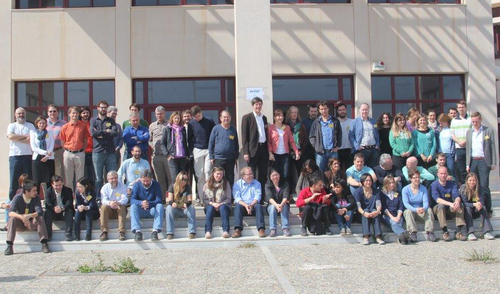
This is a group photo of the participants in the recent EU BON General Meeting in Crete, Greece.
The 2014 General Meeting brought together keynote speakers Jörg Freyhof (GEO BON, Executive Director), Marc Paganini (European Space Agency), Jerry Harrison (UNEP-WCMC) with the entire EU BON consortium to discuss collaborations between the project and other important initiatives in the areas of earth observation, particularly in remote sensing and in situ approaches to biodiversity data collection, as well as in the use and analysis of biodiversity data for forecasting and scenario building, and environmental policy.
"The high potential for satellite Earth Observations to support biodiversity monitoring is growing but is yet to be fully realised. The recent efforts of GEO BON, supported by the GEO Plenary and the CBD Conference of the Parties, to define a set of minimum essential observational requirements to monitor biodiversity trends will give considerable impetus for space agencies and for the remote sensing community to focus their work on a small set of well defined earth observations products that will serve the needs of the biodiversity community at large. In that context ESA is firmly engaged in supporting the development of these emerging Essential Biodiversity Variables (EBVs). EU BON together with ESA can be pioneers in the early development and demonstration." comments Marc Paganini, European Space Agency, on the future collaboration between the two initiatives.
The world's biodiversity is in an ongoing dramatic decline that despite conservation efforts remains unprecedented in its speed and predicted effects on global ecosystem functioning and services. The lack of available integrated biodiversity information for decisions in sectors other than nature conservation has been recognized as a main obstacle and the need to provide readily accessible data to support political decisions has been integrated into the CBD's "Strategic Plan for Biodiversity 2011–2020" and the Aichi targets. The recently published EU BON review paper points out how the project will use its potential to improve the interaction between citizens, science and policy for a better future of biodiversity protection.
EU BON aims to enable decision makers at various levels to make use of integrated and relevant biodiversity information adapted to their specific requirements and scales. Disparate and unconnected databases and online information sources will be integrated to allow improved monitoring and evaluation of biodiversity and measures planned or taken at different spatial and temporal scales. This requires strong efforts not only with regard to technical harmonization between databases, models, and visualization tools, but also to improve the dialogue between scientific, political, and social networks, spanning across several scientific disciplines as well as a variety of civil science organizations and stakeholder groups.
The project is focusing mainly on the European continent but contributes at the same time to the globally oriented Group on Earth Observations Biodiversity Observation Network (GEO BON), which itself contributes to the Group of Earth Observation System of Systems (GEOSS). EU BON will build on existing information infrastructures such as GBIF, LifeWatch and national biodiversity data centres in Europe, and will integrate relevant biodiversity data from on-ground observations to remote sensing information, covering terrestrial, freshwater and marine habitats.
Original Source:
Hoffmann A, Penner J, Vohland K, Cramer W, Doubleday R, Henle K, Kõljalg U, Kühn I, Kunin WE, Negro JJ, Penev L, Rodríguez C, Saarenmaa H, Schmeller DS, Stoev P, Sutherland WJ, Ó Tuama É, Wetzel FT, Häuser CL (2014) Improved access to integrated biodiversity data for science, practice, and policy - the European Biodiversity Observation Network (EU BON). Nature Conservation 6: 49–65. doi: 10.3897/natureconservation.6.6498
The European Space Agency (ESA) is Europe’s gateway to space. Its mission is to shape the development of Europe’s space capability and ensure that investment in space continues to deliver benefits to the citizens of Europe and the world. ESA is an international organisation with 20 Member States.
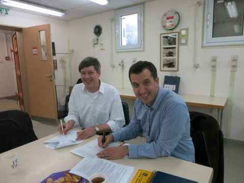
How is EU BON connected to space research? As a speaker at the EU BON General Meeting, which took place on Crete between 30 March - 3 April 2014, Marc Paganini of the European Space Agency explains the collaboration between ESA and GEO BON, and how EU BON is involved.
In the following interview he continues the topic:
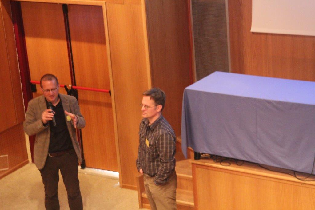
Marc Paganini (left) and Dirk Schmeller (right) at the EU BON General Meeting 2014
1) For most of the general public space and biodiversity research hardly have anything to do with each other, can you explain how the European Space Agency (ESA) and the idea of remote sensing communities make these two meet?
It is widely recognized that in-situ observations available on biological diversity are very scarce for most of the Earth’s ecosystems and are often insufficient for determining precisely the global status and trends of biodiversity worldwide. In most cases, satellite Earth Observations do not provide a direct measurement of biodiversity but, if properly used with ground collection of biodiversity data and species and habitat modeling, remote sensing can become an important and essential component of biodiversity monitoring systems. There are multiple cases where remote sensing is often the only instrument that can offer large scale monitoring, as for example in highly variable ecosystems such as wetlands or in remote areas that can hardly be monitored by field campaigns.
The recent and future evolution of the portfolio of EO satellites offers huge potential for increasing the use of EO products into biodiversity monitoring systems. The lack of data continuity has always been a barrier for the biodiversity community to invest in EO technology. A commitment from Space Agencies to provide sustained observations on the long term is a strong incentive for the biodiversity community to invest in Space. The Sentinel series of the European Copernicus program, together with the freely available data from other space agencies such as the Landsat family of the US Geological Survey, will bring unprecedented long-term continuity of observations for the biodiversity community. In that context, free and open data policy to taxpayer-funded satellite remote sensing imagery is becoming a "de facto" standard amongst Space Agencies and a unique opportunity for the biodiversity community to use widely EO products to monitor biodiversity trends.
2) How is the ESA involved with the aims of EU BON, where do the two initiatives intersect?
ESA and many other Space Agencies are becoming more and more committed in helping the biodiversity community at large, in improving their capacity to use remote sensing data for monitoring biodiversity trends.
First there is a coordinated action from all Space Agencies through the Committee on Earth Observation Satellites (CEOS) and its involvement in the Group of Earth Observation (GEO). The GEO is a voluntary partnership of governments and international organizations who engaged jointly in developing a comprehensive, coordinated and sustained system of observations of the Earth with the ultimate objective to enhance scientifically-sound decision making. Biodiversity is one of the primary societal benefit areas of GEO and is addressed by the GEO Biodiversity Observation Network (GEO BON). CEOS is actively involved in GEO BON, principally through the participation to its steering committee of the European, US and German Space Agencies, namely ESA, NASA and DLR. Since EU BON is the principal European contribution to GEO BON, and has, amongst its objectives, the aim to integrate biodiversity data from ground observations to remote sensing information, ESA is directly concerned by the EU BON development in using remote sensing for terrestrial, freshwater and marine realms.
Second, ESA has its own EO application development programs, and funds a wide range of Research & Development projects for biodiversity and ecosystem services. In that context, ESA has established close relationships with the European Environment Agency (EEA) but also with the secretariats and scientific bodies of major Multilateral Environmental Agreements (MEA) such as the Convention on Biological Diversity (CBD) and the Ramsar Convention on wetlands. The findings of the ESA-funded EO projects on biodiversity and ecosystem services are highly relevant to EU BON. It is therefore expected that the ESA and EU BON activities in relation to the use of RS for biodiversity monitoring will offer some convergence of evidence showcases for the whole biodiversity community.
3) How do you see the future of collaboration with EU BON?
The high potential for satellite Earth Observations to support biodiversity monitoring is growing but is yet to be fully realised. The recent efforts of GEO BON, supported by the GEO Plenary and the CBD Conference of the Parties, to define a set of minimum essential observational requirements to monitor biodiversity trends will give considerable impetus for space agencies and for the remote sensing community to focus their work on a small set of well defined EO products that will serve the needs of the biodiversity community at large. In that context ESA is firmly engaged in supporting the development of these emerging Essential Biodiversity Variables (EBVs). EU BON together with ESA can be pioneers in the early development and demonstration.
The latest EU BON publication in the open access journal Nature Conservation is now a fact. The article titled "Improved access to integrated biodiversity data for science, practice, and policy - the European Biodiversity Observation Network (EU BON)" provides an overview of the project's background, research interests and vision for the future.
Abstract
Biodiversity is threatened on a global scale and the losses are ongoing. In order to stop further losses and maintain important ecosystem services, programmes have been put into place to reduce and ideally halt these processes. A whole suite of different approaches is needed to meet these goals. One major scientific contribution is to collate, integrate and analyse the large amounts of fragmented and diverse biodiversity data to determine the current status and trends of biodiversity in order to inform the relevant decision makers. To contribute towards the achievement of these challenging tasks, the project EU BON was developed. The project is focusing mainly on the European continent but contributes at the same time to a much wider global initiative, the Group on Earth Observations Biodiversity Observation Network (GEO BON), which itself is a part of the Group of Earth Observation System of Systems (GEOSS). EU BON will build on existing infrastructures such as GBIF, LifeWatch and national biodiversity data centres in Europe and will integrate relevant biodiversity data from on-ground observations to remote sensing information, covering terrestrial, freshwater and marine habitats.
A key feature of EU BON will be the delivery of relevant, fully integrated data to multiple and different stakeholders and end users ranging from local to global levels. Through development and application of new standards and protocols, EU BON will enable greater interoperability of different data layers and systems, provide access to improved analytical tools and services, and will provide better harmonised biodiversity recording and monitoring schemes from citizen science efforts to long-term research programs to mainstream future data collecting. Furthermore EU BON will support biodiversity science-policy interfaces, facilitate political decisions for sound environmental management, and help to conserve biodiversity for human well-being at different levels, ranging from communal park management to the Intergovernmental Platform on Biodiversity and Ecosystem Services (IPBES). Additionally, the project will strengthen European capacities and infrastructures for environmental information management and sustainable development. The following paper outlines the framework and the approach that are pursued.
Original Source:
Hoffmann A, Penner J, Vohland K, Cramer W, Doubleday R, Henle K, Kõljalg U, Kühn I, Kunin WE, Negro JJ, Penev L, Rodríguez C, Saarenmaa H, Schmeller DS, Stoev P, Sutherland WJ, Tuama1 EO, Wetzel F, Häuser CL (2014) Improved access to integrated biodiversity data for science, practice, and policy - the European Biodiversity Observation Network (EU BON). Nature Conservation 6: 49–65. doi: 10.3897/natureconservation.6.6498

Researchers and the public can now have immediate access to data underlying discovery of new species of life on Earth, under a new streamlined system linking taxonomic research with open data publication.
The partnership paves the way for unlocking and preserving a wealth of 'small data' backing up research conclusions, which often become lost within a few years of an article's publication in an academic journal.
In the first example of the new collaboration in action, the Biodiversity Data Journal carries a peer-reviewed description of a new species of spider discovered during a field course in Borneo just one month ago. At the same time, the data showing location of the spider's occurrence in nature are automatically harvested by the Global Biodiversity Information Facility (GBIF), and richer data such as images and the species description are exported to the Encyclopedia of Life (EOL).
This contrasts with an average 'shelf life' of twenty-one years between field discovery of a new species and its formal description and naming, according to a recent study in Current Biology.
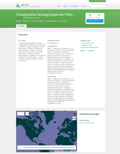 A group of scientists and students discovered the new species of spider during a field course in Borneo, supervised by Jeremy Miller and Menno Schilthuizen from the Naturalis Biodiversity Center, based in Leiden, the Netherlands. The species was described and submitted online from the field to the Biodiversity Data Journal through a satellite internet connection, along with the underlying data . The manuscript was peer-reviewed and published within two weeks of submission. On the day of publication, GBIF and EOL have harvested and included the data in their respective platforms.
The new workflow established between GBIF, EOL and Pensoft Publishers' Biodiversity Data Journal, with the support of the Swiss NGO Plazi, automatically exports treatment and occurrence data into a Darwin Core Archive, a standard format used by GBIF and other networks to share data from many different sources. This means GBIF can extract these data on the day of the article's publication, making them immediately available to science and the public through its portal and web services, further enriching the biodiversity data already freely accessible through the GBIF network. Similarly, the information and multimedia resources become accessible via EOL's species pages.
One of the main purposes of the partnership is to ensure that such data remain accessible for future use in research. A recent study published in Current Biology found that 80 % of scientific data are lost in less than 10 years following their creation.
Donald Hobern, GBIF's Executive Secretary, commented: "A great volume of extremely important information about the world's species is effectively inaccessible, scattered across thousands of small datasets carefully curated by taxonomic researchers. I find it very exciting that this new workflow will help preserve these 'small data' and make them immediately available for re-use through our networks."
"Re-use of data published on paper or in PDF format is a huge challenge in all branches of science", said Prof. Lyubomir Penev, managing director of Pensoft and founder of the Biodiversity Data Journal. "This problem has been tackled firstly by our partners from Plazi who created a workflow to extract data from legacy literature and submit it to GBIF. The workflow currently launched by GBIF, EOL and the Biodiversity Data Journal radically shortens the way from publication of data to their sharing and re-use and makes the whole process cost efficient", added Prof. Penev.
The elaboration of the workflow from BDJ and Plazi to GBIF through Darwin Core Archive was supported by the EU-funded project EU BON (Building the European Biodiversity Observation Network, grant No 308454). The basic concept has been initially discussed and outlined in the course of the pro-iBiosphere project (Coordination and policy development in preparation for a European Open Biodiversity Knowledge Management System, addressing Acquisition, Curation, Synthesis, Interoperability and Dissemination, grant No 312848).
Original source:
Miller J, Schilthuizen M, Burmester J, van der Graaf L, Merckx V, Jocqué M, Kessler P, Fayle T, Breeschoten T, Broeren R, Bouman R, Chua W, Feijen F, Fermont T, Groen K, Groen M, Kil N, de Laat H, Moerland M, Moncoquet C, Panjang E, Philip A, Roca-Eriksen R, Rooduijn B, van Santen M, Swakman V, Evans M, Evans L, Love K, Joscelyne S, Tober A, Wilson H, Ambu L, Goossens B (2014) Dispatch from the field: ecology of micro web-building spiders with description of a new species. Biodiversity Data Journal 2: e1076. DOI: 10.3897/BDJ.2.e1076

Issue 72 of the CBD Technical Series is now out focusing on "EARTH OBSERVATION FOR BIODIVERSITY MONITORING : A review of current approaches and future opportunities for tracking progress towards the Aichi Biodiversity Targets". The issue shows how earth observation technologies can and should fit into systems for biodiversity monitoring, as well as demonstrates how these approaches could further improve relevant indicators for the Aichi Biodiversity Targets. It illustrates a clear track from observations done by remote sensing platforms through Essential Biodiversity Variables to biodiversity indicators and ultimately to the assessment of progress towards the Aichi Biodiversity Targets and ultimately in support of evidence-based decision making. EU BON is also featured in this report.
The goal of the CBD Technical Series is to contribute to the dissemination of up-to-date and accurate information on selected topics that are important for the conservation of biological diversity, the sustainable use of its components and the equitable sharing of its benefits. A large and growing body of evidence has clearly established the need to disseminate synthesis publications relevant to CBD objectives and selected reports presented at CBD meetings.
The CBD Technical Series is intended to:
- Foster scientific and technical cooperation;
- Improve communication between the Convention and the scientific community;
- Increase awareness of current biodiversity-related problems and concerns; and
- Facilitate widespread and effective use of the growing body of scientific and technical information on conserving and using biological diversity.
The full report is available here.

The SUSTAIN EU-ASEAN project aiming at establishing a more sustainable and integrated research and innovation cooperation between the EU and the ASEAN region in the areas of climate action, resource efficiency and raw materials has now published its first project newsletter.
This first issue of the SUSTAIN EU-ASEAN Newsletter contains information about the outcomes from the first project Networking and Cluster Session that took place on 23 January 2014 in Bangkok, Thailand, as well as features a news item about the forthcoming sessions scheduled for 28 Match 2014 in Brussels, Belgium. More can be found in the Newsletter available here.
The SUSTAIN EU-ASEAN coordinating action will focus on climate action, resource efficiency and raw materials issues and will aim to enhance collaboration between researchers in the EU and the ASEAN region. Addressing these issues in a coherent way is vital for sustainable development that leads to economic prosperity, social cohesion and environmental integrity. Both regions have developed innovative ideas to reduce greenhouse gas emissions, to adapt to climate change, improve resource efficiency and manage raw materials.


Care about biodiversity protection and science-policy dialogue? The second BESAFE stakeholder workshop might be just the thing for you.
The BESAFE project invites all interested policy makers, NGO representatives, decision makers and people, who argue ('lobby') for biodiversity protection to take part in its second stakeholder workshop, focusing the results from the project case studies and the best ways to make them useful through a stakeholder focused web-based tool.
The workshop will be held on 13 and 14 May 2004 at the Park Inn Brussels Midi, Brussels, Belgium. To register and participate is easy just follow this link, which will take you to an easy to follow and use registration page.
On the afternoon of 13 May BESAFE will present the results of the project’s case studies and then their use and implications will be discussed with stakeholders. The morning of 14 May is reserved for a learning workshop on the best ways to unlock and present project results. As committed stakeholder involvement is crucial to BESAFE’s success, we hope that you will be able to join us in Brussels!
In a nutshell, BESAFE investigates the effectiveness of different types of arguments in convincing policy makers to take action for biodiversity protection in a variety of circumstances. The project has two specific focus areas: the interactions of environmental protection policies between governance scales, and the contribution that ecosystem services BESAFE is committed to produce practically usable results and to make them available and easily accessible through a web-based tool. This is a goal we can clearly only achieve through input and feedback from stakeholders. BESAFE is therefore set up as an interactive project in which we inform and consult those on a regular basis.
Deadline for registration is the 1st of April 2014, but registration will be closed earlier when our limit of 25 stakeholders is reached. Due to this limited capacity, registration is subject to approval.
The ASEAN-EU STI Days took place between 21-23 January 2014 in Bangkok, Thailand. During the event a special workshop "Integration of biodiversity data recording and information management systems for environmental sustainability: a call for EU-ASEAN collaboration" has been organized to stimulate EU-ASEAN collaboration in research on biodiversity informatics and integrative environmental information management.
A special EU BON dedicated presentation was given by Dr. Christoph Häuser at the workshop, which took place on 22 January. As a regional component of the Group of Earth Observation Biodiversity Observation Network (GEO BON), the EU BON project presented an innovative approach towards integration of biodiversity information systems from on-ground to remote sensing data, for addressing policy and information needs in a timely and customized manner.
Such an approach requires integration between social networks of science and policy, and technological networks of interoperating IT infrastructures. While focussing on Europe, EU BON is expected to connect and reach out globally, especially towards regions with many biodiversity hotspots such as SE-Asia.
The main objectives of the workshop were to:
- Review and compare the situation regarding relevant biodiversity and Earth observation data and information sources/providers in EU and ASEAN;
- Examine linkages between regional/national ASEAN and EU efforts with international / global biodiversity information systems (in particular GBIF, GEO BON);
- Assess and discuss national vs. regional level priorities and needs with regard to integrated biodiversity information in ASEAN and Europe;
- Identify common challenges and needs towards further integration of different types, levels, and scopes of available data and information systems;
- To address how S&T cooperation between Europe and ASEAN in the area of biodiversity and Earth observation could be further developed to better serve policy needs (especially in light of IPBES), and to contribute to common goals towards sustainable economic development.
Five other presentations were given at the workshop on behalf of Global Biodiversity Information Facility (GBIF), ASEAN Centre for Biodiversity (ACB), FishBase Information and Research Group, Forest Research Institute Malaysia (FRIM), National Center for Genetic Engineering and Biotechnology (BIOTEC), and Thailand Bioresource Research Center (TBRC). Presentations from the meeting are available to view below, or alternatively visit: http://www.stidays.net/?page_id=510
Presentations:
Christoph L. Häuser (EU BON) on "The EU BON approach for information integration" (introduction to the workshop)
Tim Hirsch (GBIF) on "The Global Biodiversity Information Facility (GBIF) – collaborating to promote data access for research and policy"
Sheila G. Vergara (ACB) on "Knowledge sharing for biodiversity conservation in the ASEAN Region"
Christine Casal (FishBase) on "Using FishBase and AquaMaps to predict IAS establishment, species ranges and risk assessment"
Leng Guan Saw (FRIM) on "Herbarium Data and Plant Conservation in Malaysia"
Lily Eurwilaichitr (TBRC) on "TBRC as an online information intermediary: towards the sustainability of biological resources"
ANNOUNCEMENT: The February 2014 update of the FishBase (www.fishbase.us and www.fishbase.ca) and SeaLifeBase (www.sealifebase.ca) websites are now available online.
FishBase stats to date: (32700 Species, 302900 Common names, 53600 Pictures, 49700 References, 2100 Collaborators, 700000 Visits/Month)
SeaLifeBase stats to date: (126000 Species, 27300 Common names, 11900 Pictures, 18200 References, 250 Collaborators)

EU BON takes care to enhance the expertise of its consortium by affiliating associate partners, an approach the project is planning to continue with. EU BON is pleased to welcome the latest addition to our list of associate partners - HaMAARAG- The Israel National Program for Ecosystem Assessment.
 HaMaarag was established in 2006, following a decade’s worth of research in Long Term Ecological Research (LTER) stations. Its main objective is to promotescience-based management of open landscapes and natural resources, for human well-being and for long-term sustainability of nature in Israel.
HaMaarag aims to:
• Generate science-based knowledge about the state of ecosystems and biodiversity in Israel
• Strengthen the relationship between scientific knowledge, management and policymaking, in the fields of natural resource and open landscape management, land use planning and nature conservation.
• Improve accessibility of this knowledge to decision-makers and the general public.
By achieving these aims, HaMaarag promotes the development of a common language, knowledge base and perspective regarding ecosystems in Israel, thus facilitating efficiency of management and policy within the relevant organizations.
The official kick-off of the EU BON project WP6 Stakeholder engagement and science-policy dialogue and WP7 Implementation of GEO BON: strategies and solutions at European and global levels took place on 18-19 February 2014 in Leipzig, Germany. The two work packages are a crucial part of the project outlining the future actions towards ensuring the integration of the project with its global counterpart GEO BON, as well as paving the road towards successful stakeholder and policy engagement.
As a result of this first meeting further short-term and long-term steps were outlined for WP6 and WP7 towards the achievement of main project objectives. These steps include shaping the future EU BON GEO BON interactions and EU BON’s approach towards stakeholder engagement.
In the following interview Ilse Geijzendorffer gives an insight on the outcomes from the meeting.
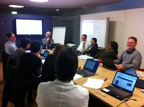
This image shows the discussions during the WP6/WP7 kick-off meeting. Credit: Eugenie Regan
1) What are the project’s main stakeholders that you are planning to approach and interact with in the future?
EU BON aims to develop a blue print for a data infrastructure for data handling, storage, indicator computation and transfer of knowledge via a data portal available to knowledge seekers. This data infrastructure thus has to be useful to data holders who want their data to be used (e.g. citizen scientists, nature associations, scientists) and to those that seek knowledge (e.g. reporting bodies). EU BON reaches out to these stakeholders and to bodies that would be interested to host or have such a data infrastructure themselves. Our first stakeholder round table focused on European knowledge seekers and existing data portals. Our second stakeholder round table planned for this summer will focus on citizen scientists and the organisations that currently handle the citizen science data, to receive input on what these two stakeholder groups would like to see in such a data infrastructure blue print.
At the same time we reach out to ongoing platforms that consist of networks of knowledge and that have needs regarding their data flow. A very important partner in the data infrastructure development is GEO BON. The coordination of GEO BON has just changed and EU BON will reinforce the ties with GEO BON during the General Assembly in Crete coming in April.
2) Science-policy dialogue proves to be a crucial part for the success of large scale projects like EU BON, how are you tackle this challenge?
The objective of EU BON is a moving target in the sense that the blue print for data infrastructure will need to suit the needs for current and future monitoring. Additionally, the actual implementation, funding and hosting of such an infrastructure could be within a structure that may not yet exist in that form today. Changes in mission, coordination and targets occur constantly. To profit from lessons learned, we are in close contact with the Biodiversity Knowledge Project; a project that has already gained experience in the last four years in identifying the most important elements for handling data requests from knowledge seekers and in developing a suitable management plan.
For EU BON to achieve and reach its moving target, we keep in touch with the changes within the biodiversity knowledge landscape (e.g. progress in IPBES, CBD reporting, European targets ad evaluations); we explore multiple scenarios for the data infrastructure, the business plan and the implementation options; and we collaborate with a large range of stakeholders to include not only their ideas and needs, but also the transitions that they go through.
A joint EU BON WP3-WP4 meeting took place on 25-27 November 2013 in Solsona, Spain. The main aim of the meeting was to officially kick off WP3 and provide forum for discussion of the planned work. The two work packages were presented with their main aims, scope and objectives. The place of the two work packages in the broader framework of EU BON, and the cross-links between the two, were also discussed.
In the following interview Hannu Saarenmaa and Klaus Henle share insights from the meeting:
1) WP3 ‘Improving tools and methods for data analysis and interface’ and WP 4 ‘Link environment to biodiversity: analyses of patterns, processes and trends’ are two of the core work packages in EU BON that are expected to accumulate a lot of genuine data and develop new tools for data analysis and interface. Can you explain in short what will your main activities involve?
HS: I can contribute to the project and these WPs a large-scale modelling technology from the BioVeL project that can process hundreds of species. This would be an engine to compute the first real Essential Biodiversity Variables (EBV).
KH: Our main activities will involve an analysis how available effort is best allocated in time and space to optimize results from monitoring. We will further assess how different sources of uncertainty influence conclusions derived from the analysis of monitroing data
2) What were the main results of the meeting in terms of the planned work and WP management?
HS: It was proposed to set up an EBV Task Force across the EU BON project. If we can do that, it would really give a thrust for the project. If we could pick up the Database of Monitoring Schemes from the EUMON project, as discussed, that would give us access to some large datasets.
KH: One main result was the identification of the concrete responsibilities (e.g. data provision, data analysis for terrestrial, freshwater and marine biodiversity) within the workpackage and to identify explicitly links to other workpackages.
3) What novelty will the work in these two work packages bring and what will the major results be?
HS: If they can create a new Ecological Niche Modelling algorithm that can also deal with spatial patterns, that would be interesting. Such a model actually exists in MigClim, but it is not yet widely used.
KH: We will get recommendations how monitoring can be optimized and a more comprehensive understanding of changes in biodiversity and their underlying causes
4) What are the immediate planned activities and when can the first results be expected?
KH: The most immediate planned activities it the screening of potentially available data needed for the analysis
5) How will the WP3/4 interact with GEO BON?
HS: The proposed EBV Task Force would need to interface very closely with GEO BON.
KH: We are engaged directly with key members of GEO-BON; e.g. we have regular meetings with Henrique Perreira.

